
Douglas County ZIP Codes Across Fourteen Areas
The county's verified core list has fourteen ZIP areas. They describe postal delivery geography, not a clean outline of every town or subdivision. The most useful starting point is the county map paired with a full-address check. A postal city can be printed on an envelope even when the parcel sits in an unincorporated community or outside the named municipality. Use the table as a research index, then confirm the exact delivery unit before treating a result as local.
| ZIP | Areas Covered | Post Office or Postal Label | Notes |
|---|---|---|---|
| 80104 | Castle Rock central and east; county-seat area | Castle Rock delivery unit | Generally aligns with central Castle Rock, with nearby rural edges on the county map. |
| 80108 | Castle Pines North, Castle Pines, and Castle Rock-edge communities | Castle Rock postal label or delivery area | Castle Pines legal identity and Castle Rock postal text can differ. |
| 80109 | West and northwest Castle Rock growth area | Castle Rock delivery unit | Use the parcel and municipal layers for the jurisdiction. |
| 80116 | Franktown and southeast rural Douglas County | Franktown Post Office label | Rural address points make exact ZIP+4 validation important. |
| 80118 | Larkspur and nearby southwest Douglas County | Larkspur postal label | Small-community place names should stay separate from ZIP text. |
| 80124 | Lone Tree, Acres Green, Heritage Hills, and nearby north county | Lone Tree postal label | Association and municipal edges do not equal the postal outline. |
| 80125 | Roxborough Park and southwest or northwest foothill edge | Littleton postal label or Roxborough delivery area | A Douglas County parcel can carry a Littleton postal city. |
| 80126 | Highlands Ranch west and central areas | Littleton or Highlands Ranch delivery label | Highlands Ranch is unincorporated. |
| 80129 | Highlands Ranch central and east areas | Littleton or Highlands Ranch delivery label | Subdivision and county GIS add the local boundary context. |
| 80130 | Highlands Ranch east, south, and county edge | Littleton or Highlands Ranch delivery label | Postal text is not a city-incorporation test. |
| 80131 | Louviers and southern unincorporated Douglas County | Louviers Post Office label | Street and route names deserve an address-point check. |
| 80134 | Parker, north and east Parker, and nearby county communities | Parker delivery unit | The postal area crosses municipal and unincorporated boundaries. |
| 80135 | Sedalia and foothill or rural communities | Sedalia Post Office label | Rural delivery patterns make ZIP+4 confirmation useful. |
| 80138 | Parker, east and southeast Parker, and county-edge areas | Parker delivery unit | The label can extend beyond the Town of Parker line. |
These are the fourteen core areas documented in county sources. The table does not assign a single main post office to the whole county because delivery units vary by address. It also does not turn a postal label into a resident roll. A person can own a parcel in one ZIP while mailing tax records elsewhere, and an election record follows its own public-field rules. Preserve the original postal city, ZIP, municipality, and unincorporated community in separate notes so a later search can explain an apparent mismatch.
Douglas County ZIP Code Directory Geography
Douglas County's ZIP geography crosses the county's varied place names. Castle Rock and Parker have town-centered ZIP areas, while Franktown, Larkspur, Louviers, and Sedalia retain small-community or rural postal identities. Roxborough Park and the Highlands Ranch areas show why postal language needs a second field. The mail label may say Littleton even when the parcel is in Douglas County and the local community is not part of the City of Littleton.
Lone Tree and Acres Green can share a broad postal area while their civic records sit in different systems. Castle Pines can appear with a Castle Rock postal label. Those are not errors to clean away. They are joins between the USPS delivery system, county parcel geography, municipal boundaries, subdivision names, and local association records. A ZIP code directory is strongest when it records each label instead of replacing one with another.
The county map also displays edge labels that are useful clues but not a second verified core list. Treat them as candidates for a boundary review, not as proof that a full ZIP serves Douglas County residents.
Highlands Ranch: Douglas County ZIP Geography
Highlands Ranch is an unincorporated Douglas County community with planned subdivisions, schools, metro districts, an association layer, and several ZIP areas. Its Littleton postal label is convenient for delivery, but it does not make the community a legal part of Littleton. A postal directory that lists only the postal city can therefore send a records search to the wrong jurisdiction.
For an address in 80126, 80129, or 80130, keep the community name, subdivision, county, ZIP, and municipal status together. The county GIS and Assessor layers identify the parcel and boundary. Community records add another layer. A postal label can help find a record, but the parcel and custodian decide which county, town, association, or district page applies.
Highlands Ranch also spans more than one ZIP area. That makes the full address more useful than a community name alone. The same method helps in Roxborough Park, Castle Pines, Parker-edge communities, and rural Douglas County.
Find Douglas County Residents by ZIP Code
A ZIP filter is a narrowing tool. It is not a countywide browse of every person. The Assessor can search property records by address, city, and ZIP, and its advanced application exposes a ZIP Code criterion. The state voter lookup uses ZIP as one match field beside a person's name and birthday. The Recorder and Treasurer do not provide a ZIP-wide public browse, so a ZIP result must be joined to a parcel, a legal description, or a permitted election product.
- Validate the address. Use the USPS address lookup and keep the returned ZIP or ZIP+4 with the original street wording.
- Run the Assessor filter. Select “Address, City, and Zip Code” in the standard search, or use the ZIP Code criterion in Advanced Search.
- Read the parcel record. Separate situs address, owner mailing address, account number, state parcel number, legal description, subdivision, and municipality.
- Use the voter lookup for one person. Enter first name, last name, ZIP, and birthday. Try a prior home ZIP only when the state instructions call for it.
- Request a larger election file only when needed. Colorado voter products have request rules and fees, and protected records are excluded.
Once a ZIP narrows the search to a street segment, the address-keyed records chain belongs in the Douglas County street directory workflow. That next step uses parcels and legal descriptions rather than treating ZIP text as the record key.
Douglas County ZIP Filters in the Assessor
The Douglas County Assessor's standard search has a clear field order. The scope controls what the term means, so a ZIP search should not be run as a free-form owner-name query. Results carry a disclaimer about accuracy and completeness. Record the search date and source before comparing a parcel with another office.
| Field or control | Type | Required | How it helps a ZIP search |
|---|---|---|---|
| Search scope | Dropdown | Yes | Choose All, Address/City/Zip Code, Owner Name, Account Number, or State Parcel Number. |
| Search County Properties | Text input | Generally yes | Enter a street term, owner name, or parcel term after choosing the scope. |
| Search | Button | Not applicable | Submits the selected scope and search term. |
| Sort | Dropdown | No | Order broad results by Best Match, Account, Owner, or Address. |
| Result disclaimer | Acknowledgement | Before detail | Signals that the record is an Assessor record, not a guaranteed complete resident list. |
The Assessor's result card can show owner names, mailing address, situs address, account and state parcel numbers, legal description, subdivision, tax district, values, sales, improvements, and map links. Those fields explain a ZIP assignment, but an owner mailing address can be outside the parcel or county. Do not merge the two address types.
The Douglas County Assessor Advanced Search exposes the ZIP criterion alongside owner, address, parcel, sale, improvement, tax, and subdivision fields. Its dynamic report path is useful when a single parcel card is too narrow, but the exact report output should be read as county property data, not a household directory.
The Douglas County Assessor Advanced Search screen shows how a ZIP field sits beside other property criteria.
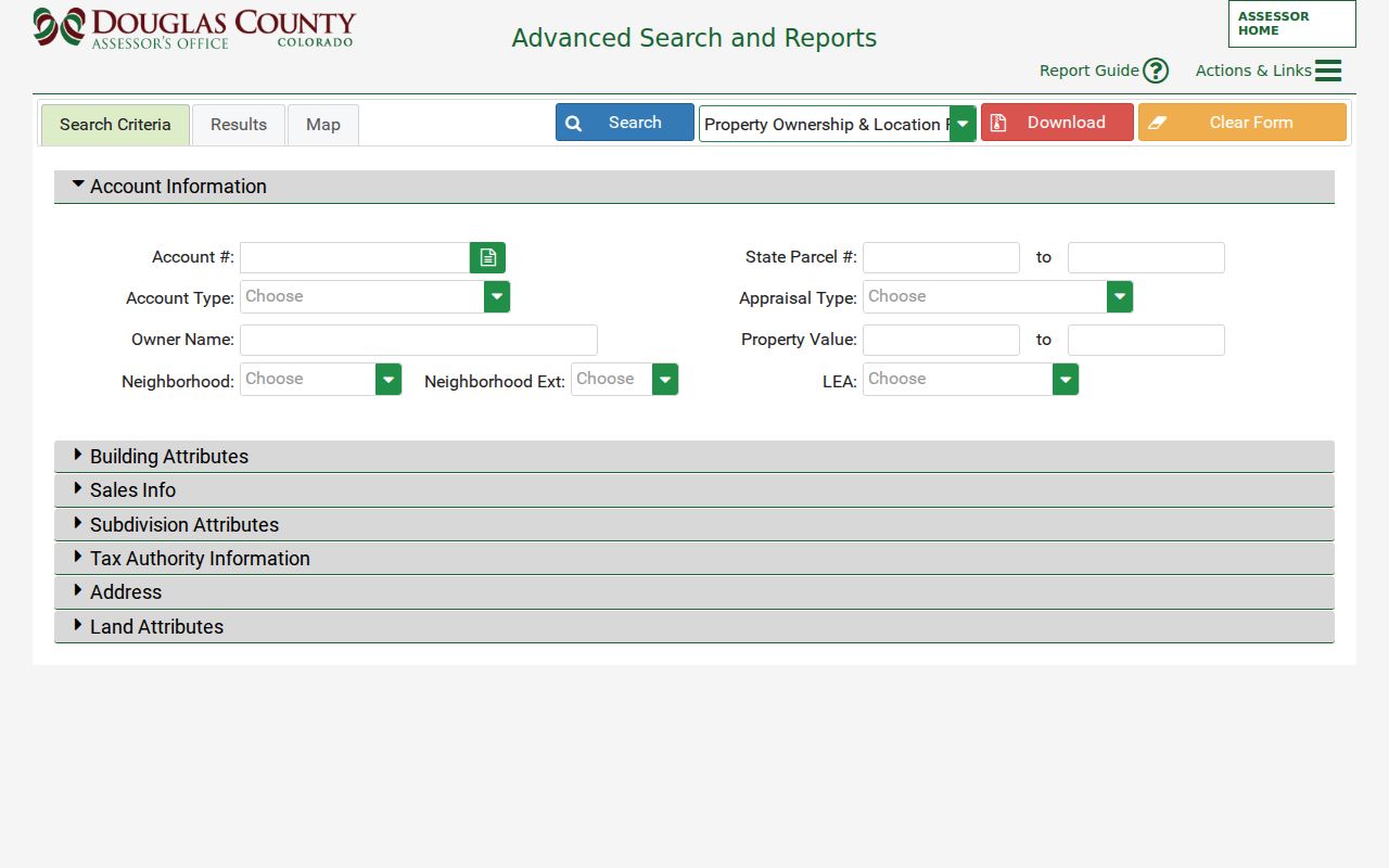
The field-level view makes the ZIP code directory practical for parcel discovery while keeping the search scope visible.
Douglas County ZIP Detail in Lone Tree
Lone Tree's public Accela lookup is an example of a municipal address system sitting beside county records. Its available lookup modes include address, parcel information, owner, record information, and licensed professional. The documented address fields include street number, direction, street name, street type, unit number, city, state, ZIP, and unit type.
That level of detail helps explain why a ZIP code directory should not collapse an apartment or unit address into a street name. A unit number can be the difference between a useful permit or property match and a false one. The municipal portal does not replace the Assessor, Recorder, or USPS check. It adds a local project and address layer for the part of Douglas County it serves.
The Lone Tree address and property lookup illustrates the local side of ZIP research.
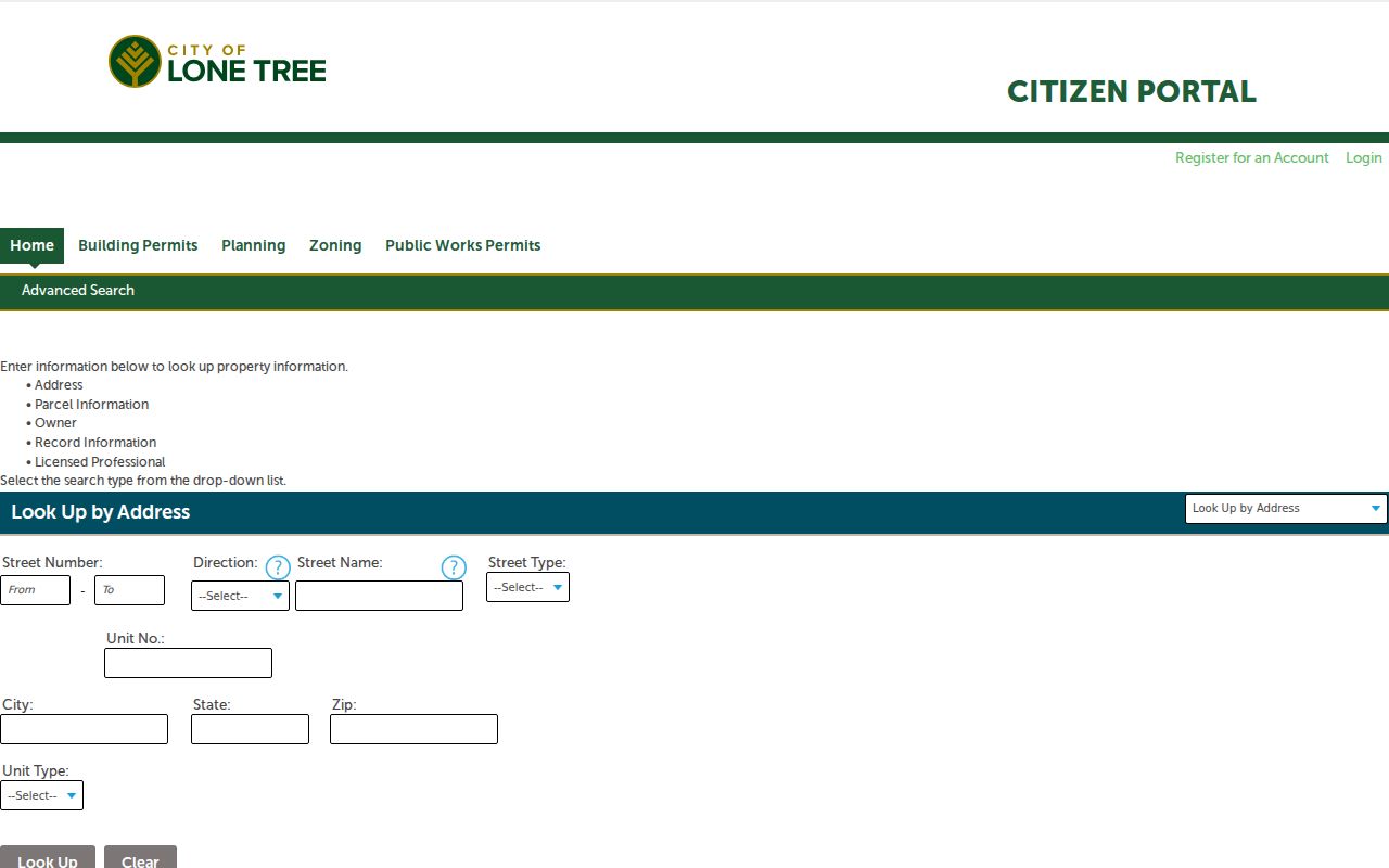
The screen reinforces a simple rule: match the full address before joining a postal value to a person, parcel, or permit.
Douglas County USPS ZIP+4 Address Check
The county Assessor directs researchers to USPS ZIP+4 verification for a full address. ZIP+4 adds a delivery segment to the five-digit ZIP. It can separate a street range, building, floor, or delivery unit that shares the same broader postal area. The exact returned text should be kept with the search record rather than guessed from a map.
- ZIP versus ZIP+4
- A ZIP identifies a broad delivery area. ZIP+4 adds a more precise delivery segment for the submitted address.
- PO-box ZIP
- A postal assignment used for a post-office box or box group. It does not establish where a parcel or person lives.
- Unique ZIP
- A code assigned to one organization or facility rather than a broad neighborhood. No unique Douglas County code was verified for the core list.
- Carrier route
- A delivery route inside a postal area. It is a mail-service concept, not a legal neighborhood or municipal boundary.
The USPS ZIP Code Lookup by address is the best final check for a complete address. The USPS ZIP+4 service is another official route referenced by the Assessor. Either route should be used before a narrow ZIP search, especially for rural roads, units, and edge communities.
The address-based USPS lookup screen keeps postal validation separate from county ownership records.
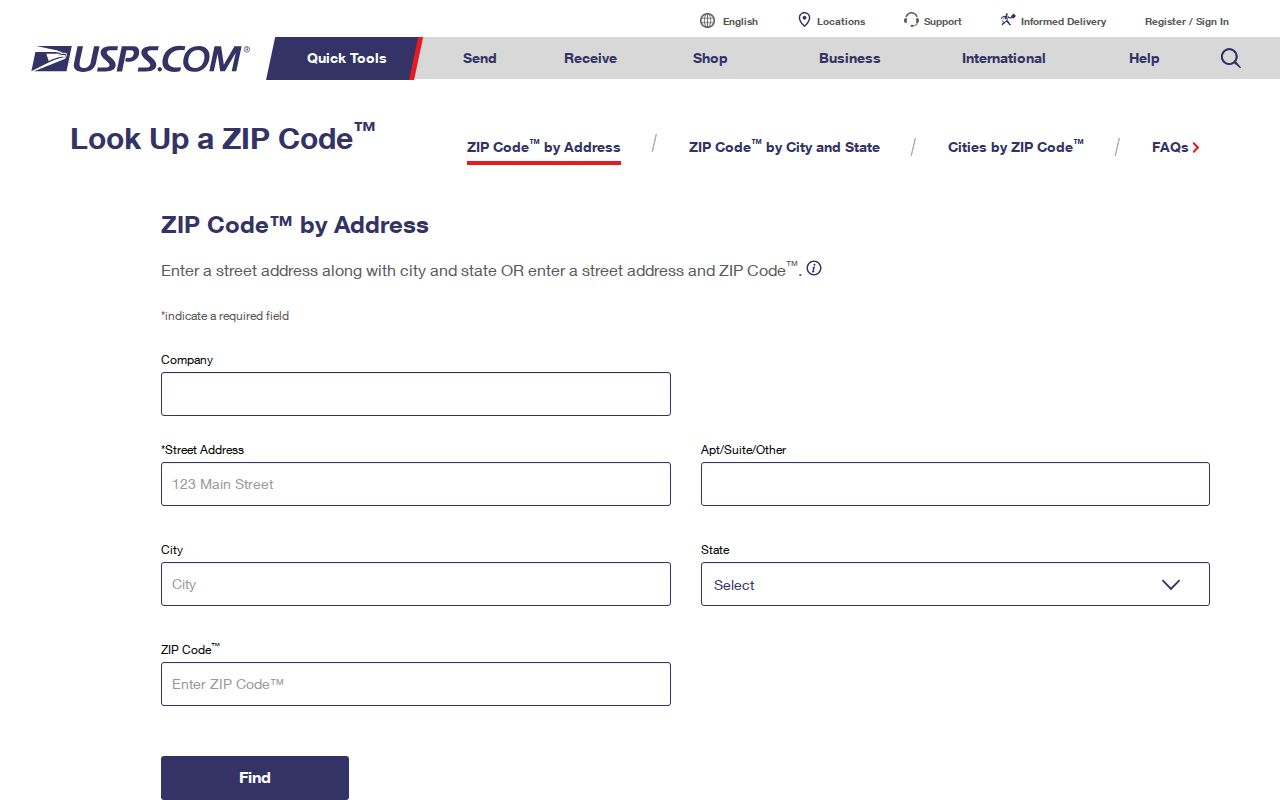
The result belongs to delivery geography. The Assessor and GIS still decide the parcel and jurisdiction joins.
ZIP Code Boundaries and Douglas County Jurisdiction
A postal boundary and a city limit answer different questions. The county's ZIP map can place a postal label beside municipal lines, subdivision borders, tax districts, and unincorporated areas. The Assessor's municipal-boundary and subdivision layers are therefore needed when the result must be routed to a court, permit office, association, or local records custodian.
Castle Pines may use a Castle Rock postal label. Parker's postal areas can reach beyond the Town of Parker. Littleton labels appear in Highlands Ranch and Roxborough Park. Lone Tree, rural communities, and county-edge parcels add more examples. These joins should be recorded, not silently corrected to the nearest city name.
Postal city, situs address, owner mailing address, legal description, municipality, and county are separate fields. The legal description identifies the land in a deed. The situs address identifies where the parcel sits. The owner mailing address identifies where tax correspondence goes. The postal city identifies delivery geography. Keeping those meanings intact prevents a postal search from promising more than the source can show.
Douglas County Map Labels at the Edge
The Assessor's April 29, 2021 ZIP map displays adjacent or edge labels 80016, 80106, 80107, 80112, 80120, 80133, and 80863. They are boundary candidates only. The map does not say that each is a full standard ZIP serving Douglas County residents, and no official static table was located that assigns every edge label to a Douglas County post office.
The Assessor real-estate data center provides the county's data and map context. It is useful for comparing a ZIP layer with parcel and boundary information, but an edge label still needs an exact USPS result. If the postal lookup and county map appear to disagree, preserve both values and investigate the address point rather than choosing one by appearance.
The Assessor real-estate data center view places ZIP geography beside the other property and map resources.
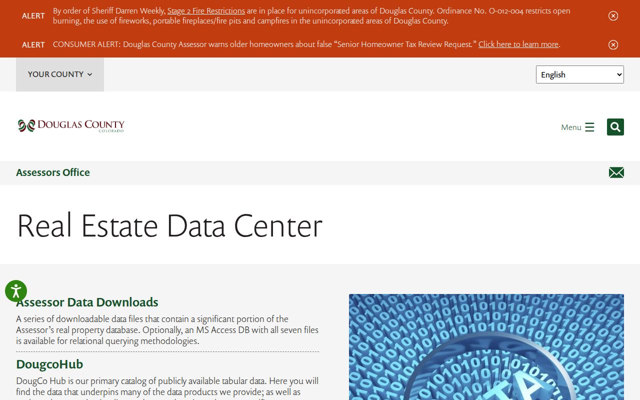
The map context is a boundary clue. It does not expand the verified fourteen-area core list or create a ZIP-wide Recorder search.
Douglas County ZIP Search Limits
ZIP search has clear limits. The Recorder's Landmark Web index is organized around names, legal descriptions, dates, reception numbers, book and page, and document paths. It has no ZIP-wide public browse. The Treasurer uses situs address, owner, account, or parcel searches and likewise does not offer a ZIP-wide resident result. A ZIP can help locate a parcel in the Assessor, but it cannot substitute for a legal description.
The state voter lookup is a one-person match tool. It does not provide a public street roster, and protected voters, preregistered protected persons, full birth date, identification numbers, signatures, email, and how a person voted are excluded from ordinary public products. County voter files and statewide report requests have their own forms, products, fees, and limits. When a needed county record is not exposed online, a specific Colorado Open Records Act request can be routed to the proper custodian.
Use the postal clue lawfully. A postal directory supports personal research, family history, civic understanding, and address verification. It is not a reason to publish a household list or use records to stalk, harass, intimidate, or harm anyone. Confirm sensitive facts with the agency that holds the record.
For a reliable Douglas County search, use the ZIP as one join key, not as the final answer. Pair it with the exact postal result, county parcel, legal description, and the access rule for the record set being consulted.